|
BALTIMORE RAILROAD BIRTHED TRANSPORT IN CIRCLES
|
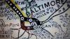
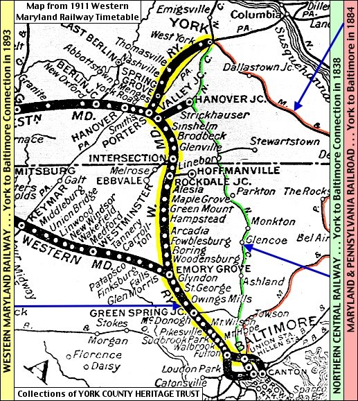
| 1911 Western Maryland Railway Baltimore City Map Detail |
From 1828 to 1830, mules were used to move people, goods, and of course, more rails, bolts, and ties. In 1830, Iron Horses
began their journeys.
"The Baltimore and Ohio Railroad in the Civil War" - American Battlefield Trust
Baltimore Streetcars and Trains Transportation Legend
[Click link above, scroll down, & peruse the 2 maps]
Notice that, even with various streetcar owners, there are circle loop lines. The routes were longer. The #2 route, travels
from/to Fort McHenry all the way to Druid Hill Park.
Now on the right hand side, go to see other U.S. cities' oldest streetcar maps. All had circle loop lines, not several bunched
up busses all going on the same streets in their downtowns, like Baltimore, Charles, and Pratt Streets, just name a few.
Circle loop lines move a major amount of people short distances, enabling faster service (streetcars never had schedules because
they came so often), even when transferring, as little to no wait for connection. [MTA is opposite, with often have to walk
several blocks for transferring.]
[Choices to walk a few blocks this way or that way. This allowed more neighborhoods to be serviced, and get to where they
wanted to go quickly. Streetcars always quicker, and smooth ride.... No bundling of routes.]
| IT'S TIME TO ALLOW US TO GO TO THE ZOO AGAIN!!!! |

|
| PANDAS WANT TO GET TO THE ZOO TOO! STREETCAR ALWAYS TOOK US!!!! |
| SUBURBANITE DESTINATIONS WITHOUT HURTING BALTIMORE |
|
| EVERY 5 MINUTES HI-SPEED AUTOMATED TRAINS TRAVELING ALONG BELTWAY WITH CONNECTORS |
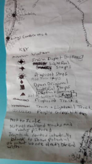
KEY:
|
| 1911 Western Maryland Railway Baltimore City Map Detail |

McKeldin Highway [Known more commonly called, "Baltimore Beltway" or simply, "695"] is 51.61 Miles around
| WESTERN MARYLAND RAILWAY 1911 MAP |
|
| S. H. Smith Annotations on Map (2015) from Collections of York County Heritage |
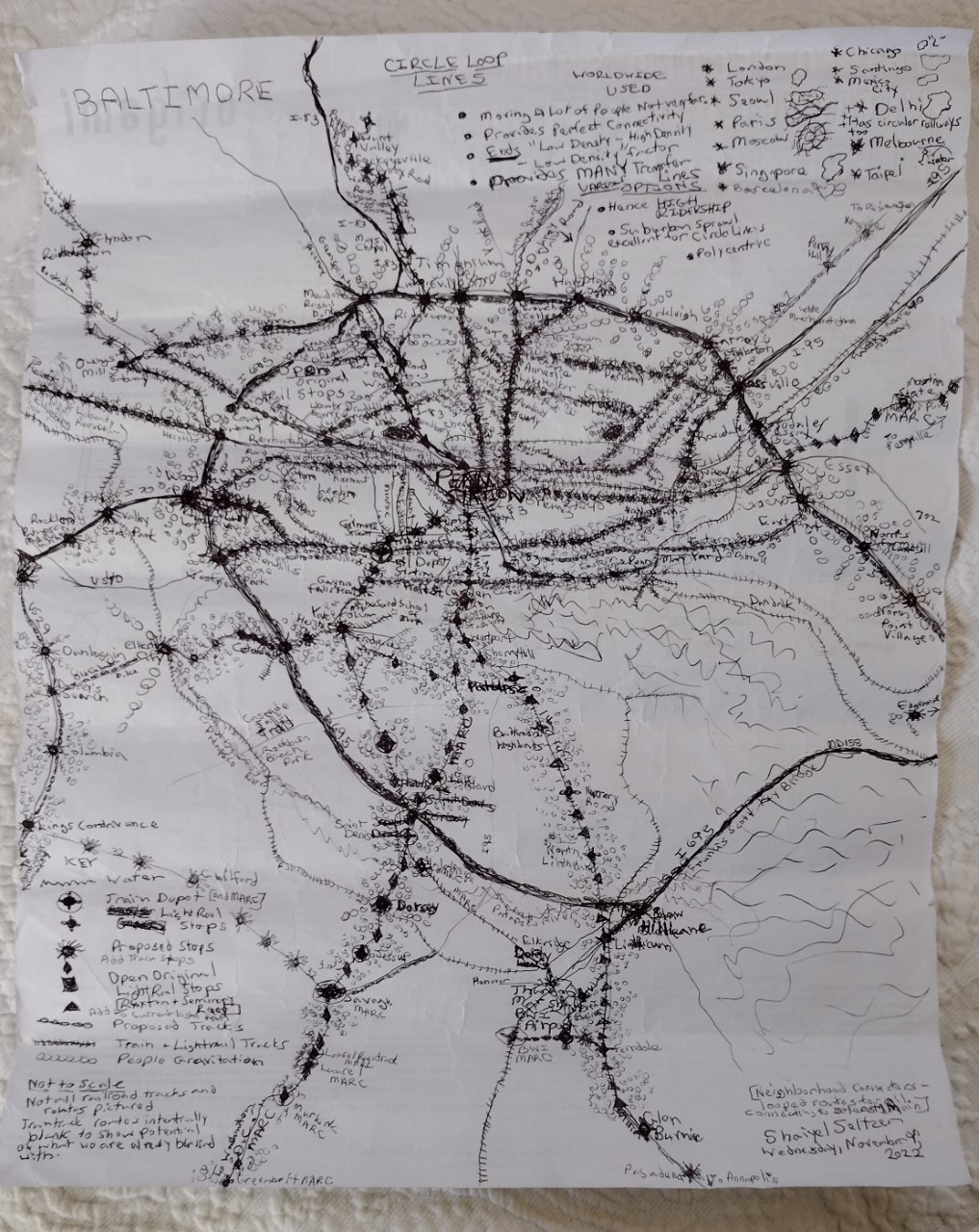
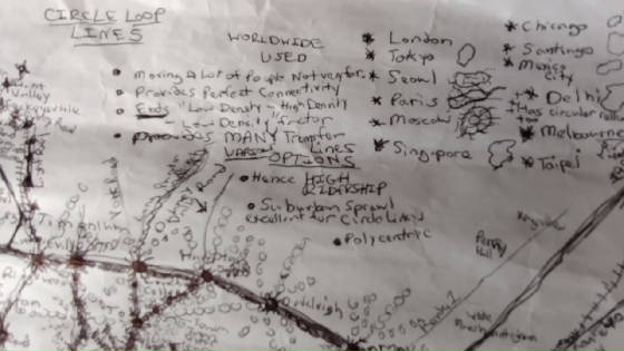
| WHY CIRCULAR LOOP LINES???? |
|
| SOME INTERNATIONAL CITIES' CIRCULAR LOOP NETWORKS |
| TRAINS GAVE MARYLANDERS PROSPERITY & EQUAL FOOTING |
|
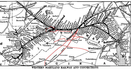
| WESTERN MARYLAND RAILWAY AND CONNECTIONS |
.......................................................................................................................................................................................................................................................................................................................................................................................................................................................................................................................................
ROUTE MAP: "Transit System Map of Baltimore" - The Baltimore Transit Company (1950)
CENTRAL ROUTE MAP - The Baltimore Transit Company (1950)
Baltimore Map - Landmarks & Businesses (1957)
"Baltimore - Seaport of Industrial America" - (1957)
"What Atlanta is doing, and what Baltimore should be doing is to set up a system of fringe parking lots and commuter
rail which connects to an inner city system of 'peoplemovers' which will carry people over the whole inner city area. The
streets can be turned back to people as they are being in many places all over the world, and we could redevelop the
cleared areas of the city for people as nice places to live instead of pollution generators."
In other words, "A train circle looped system on outskirts of Baltimore City, with Streetcar Main Connectors and
Streetcar Neighborhood Connectors will clear the air - permanently."
| SUBURBANITE PUBLIC TRANSPORT IN/OUT OF BALTIMORE |
|
| PUBLIC TRANSPORT OF SUBURBANITES TRAVEL TO AND BEYOND BALTIMORE |
| STREETCAR MULTI-NEIGHBORHOOD CONNECTORS |

|
| INTERLOCKING STREETCAR LOOPED NEIGHBORHOOD CONNECTORS |
| MOVEMENT OF SUBURBANITES FLOW IN & OUT BALTIMORE |
|
| SUBURBANITE PUBLIC TRAVEL TO & BEYOND BALTIMORE |
| VIBRANT PEOPLE |

|
| PROPER TRAFFIC MOVEMENT ~ STAYING AWAY FROM BALTIMORE CENTERS |
| PEOPLE GRAVITATION TO PUBLIC TRANSPORT'ROUND BALTO |

|
| PEOPLE GRAVITATING TO PUBLIC TRANSPORT AROUND & INTO BALTIMORE DESTINATIONS |

| INFINITY |

|
| - Behre and Jeremy |
.........................................................................................................................................................................................................................................................................................................................................................................................................................................................................................................................................
WORLD CIRCLE LOOPED TRANSPORTATION LINES
WORLD TRANSIT

'Mount Clare Station, Baltimore, Part of Underground Railroad" - "Inside Edition" (2022)
"The Last Station: A Landmark is Reborn in the Birthplace of the American Railroad" - Baltimore Magazine (2023)
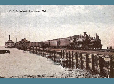
The Baltimore & Eastern operated several light-density branch lines east of Chesapeake Bay. This section ran from McDaniel
(St. Michaels Island) through Easton, Hurlock, Salisbury, and Berlin to Ocean City, to - the Atlantic Ocean.
It Was First To Be a Railroad Bridge, Campbell Bridge - a Private Sector Bridge
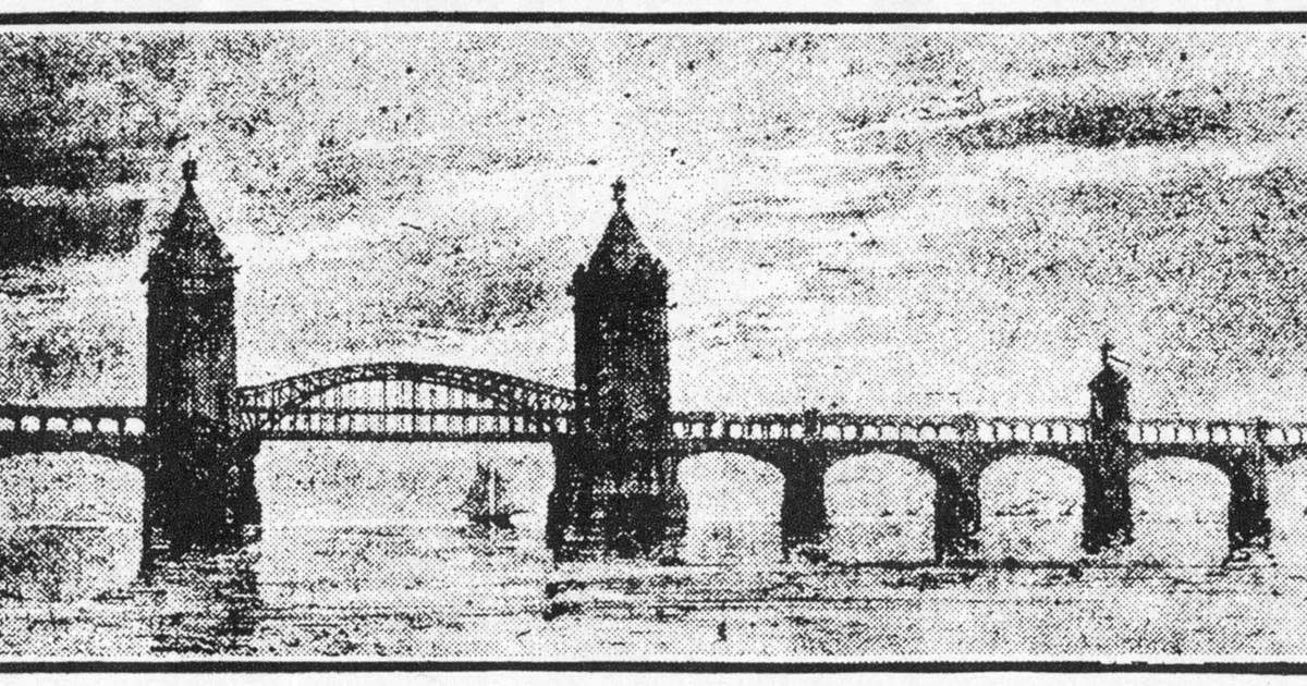
"Campbell's Bridge": "Chesapeake Bay Bridge may get A New Span, But its Origins Date Back to the Railroad Age" - The Baltimore
Sun (2022)
";Before the Bridge' To Be Featured at Museum" - The Democrat Star (2010)
|
| 1910SteamboatatClaiborneWharfandBaltimoreChesapeakeAndAtlanticTripToOceanCity.jpg |
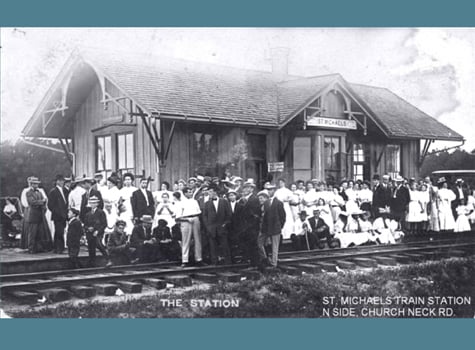
| SAINT MICHAELS TRAIN STATION |
|
| BALTIMORE, CHESAPEAKE, & ATLANTIC RAILROAD |
Eastern Shore Railroad Train: Pocomoke, Maryland to Cape Charles Virginia - Millennium Force (2014)
...................................................................................................................................................................................................................................................................................................................................................................................................................................................................................................................................
|