|
TANEYTOWN ~ FREDERICK ~ ELLICOTT CITY ~ BALTIMORE
Stop names may change.
Zoom in to Baltimore [BAL], and then find Taneytown (NW) to follow the route stops. Automobiles cannot access much of the
route. Mapquest shows where houses... are.
|
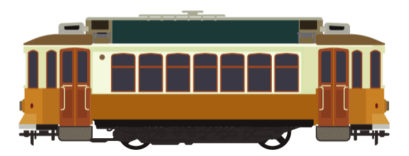
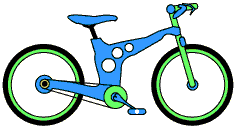
| UNLIMITED BICYCLES WELCOME!!!! |
TANEYTOWN, MARYLAND

TB1. ANGELL
[Angell Road near Francis Scott Key Highway 194 at Westminster Hydraulics & Ferrell Gas]
Carroll County
TB2. GRANT
[Grant Street & Sheridan Street (More houses being built east & north of street)]
Carroll County
TB3. MEADES CROSSING
[Grant Street & Meades Avenue]
Carroll County
TB4. PINEY CREEK
[Kenan Street]
Carroll County
TB5. CRANE
[Cranemasters - Railroad]
Carroll County
TB6. POSTCARD MILLS
[Robert Mills Road TANEYTOWN HIGH SCHOOL, U.S. POSTAL SERVICE, & Taneytown Recreation Park]
Carroll County
TB7. BALTIMORE STREET CITY
CENTER
[East Baltimore Street Route 140 & TANEYTOWN POLICE DEPARTMENT]
Carroll County
TB8. ANTRIM 1844
[Hotel On railroad route]
Carroll County
TB9. LONG MOUNTAIN VIEW
[Allendale Avenue Close to Long Mountain View]
Frederick County
TB10. CROUSE MILL
[Crouse Mill Road]
Carroll County
KEYMAR, MARYLAND
TB11. FRANCIS SCOTT KEY ANNEX
[Unmarked road]
Carroll County
TB12. FARMERS' DEPOT
[Unmarked and/or Private road]
TB13. SHARRETT - KEYMAR AIRPARK
[Sharrett Road & MD 42]
TB14. BIG PIPE CREEK
[Near the Creek. Assessable to local business.]
Carroll County
TB15. MIDDLEBURG
[Middleburg Road]
Carroll County
TB16. WHY NOT?
[Y Road ~ Maryland Midland Railway Line]
Carroll County
TB17. LITTLE PIPE CREEK
[Keymar Road]
Carroll County
TB18. WOODEN KEY
[Keymar Road]
Frederick County

LADIESBURG, MARYLAND
TB19. GOOD INTENT
[Good Intent Road]
TB20. LADIESBURG
[Warner Road & Woodsboro Pike 194]
TB21. SMITH
[Smith Lane & Woodsboro Pike 194]
TB22. BAKER
[Baker Road NEW MIDWAY ELEMENTARY SCHOOL]
NEW MIDWAY, MARYLAND
TB23. NEW MIDWAY
[Renner Road & Woodsboro Pike 194 U.S. POST OFFICE]
TB24. OAK HILL
[Oak Hill Road]
WOODSBORO, MARYLAND
TB25. QUARRY
[S.W. Barrick & Sons 11609 Legore Bridge Rd, Woodsboro, MD 21798]
TB26. WOODSBORO
[Woodsboro Historical Society Old Creagorstown Road & James Street]
TB27. ELIZABETH
[Elizabeth Street & Gravel Hill Road at James Street]
TB28. BELL
[At Bell Court]
TB29. HILDEBRAND
[Hildebrand Lane near Adams Street]
Frederick County
TB30. ROCKY GLADE
[Stop at Hildebrand Lane near Weinberg Court]
WALKERSVILLE, MARYLAND
TB31. GLADE
TB30. [Glade Road at Glade Valley Golf Club]
Frederick County
TB32. FARMS
[Unnamed and/or private road]
TB33. HERITAGE FARM PARK
[Devilbiss Bridge Road (near Solar Drive) To the back of GLADE ELEMENTARY SCHOOL]
TB34. WINTERBROOK
[On Glade Road Between Winterbrook & Polaris Drives - open path]
Frederick County
SONYA, This Will Be Your Stop! :-) Walk on Bedrock Drive and then turn right onto Glade (going North). Glade meets Walkersville
Southern Railroad rails!
TB35. MAIN STREET
TB36. WALKERSVILLE SOUTHERN RAILROAD
[Mill Street, West Pennsylvania Avenue, & Port Circle]
TB37. GLADE CREEK
[Hampton Place & Georgetown Road]
TB38. WALKERSVILLE FIELDS
[Walkersville Community Park & WALKERSVILLE HIGH SCHOOL]
Frederick County
TB39. WALKERSVILLE NATURE
[Fountain Rock Nature Center, WALKERSVILLE ELEMENTARY SCHOOL & Softball Field]
TB40. FOUNTAIN ROCK PARK
[Fountain Rock Road. Fountain Rock Spring. Parking Lot.]
TB41. MONCOCACY RIVER
[At Miscellaneous Metal - Steel. Near Retreat Road]
FREDERICK, MARYLAND
TB42. TUSCARORA CREEK
[Brook Valley Road clearing]
TB43. MONOCRACY
[Cierestory Park, SHA Monocacy Boulevard Park and Ride Near 2810 Monocacy Blvd, Frederick, MD 21701]
TB44. SPRING BANK FARM
[Frederick Health Village]
TB45. MARKET SQUARE
[Stop at offshoot of 7900a Wormans Mill Rd, Frederick, MD 21701]
TB46. CLEMSON CORNER
[Stops in front of Wegmans Food Market. Next to Worman's Mill Industrial Park]
TB47. JOHNSON BANNER
[Near North Market Street - Serving The Bottling Plant Apartments, GOVERNOR THOMAS JOHNSON MIDDLE SCHOOL, and The Banner
School]
TB48. NORTHEAST JOHNSON
[North East Street & East 16th Street GOVERNOR THOMAS JOHNSON HIGH SCHOOL]
TB49. EAST 15TH
[East 15th Street & North East Street]
TB50. EAST 14TH
[East 14th Street & North East Street]
TB51. EAST 13TH
[East 13th Street & North East Street Monocacy Village Park & Frederick Pump Track]
TB52. DELAWARE
[North East Street & Delaware Road]
TB53. EAST 9TH
[East 9th & North East Streets]
TB54. EAST 8TH
[East 8th & North East Streets]
TB55. EAST 7TH
[East 7th & North East Streets]
TB56. EAST 6TH
[East 6th & North East Streets]
TB57. EAST 5TH
[East 5th & North East Streets]
TB58. EAST 4TH
[East 4th & North East Streets]
TB59. EAST 3TH
[East 3rd & North East Streets]
Frederick County
TB60. EAST 2TH
[East 2nd & North East Streets]
Frederick County
TB61. CHURCH
[East Church & North East Streets]
TB62. PATRICK
[Patrick & North East Street U.S. POSTAL SERVICE]
TB63. CARROLL CREEK
[East Street]
TB64. FREDERICK TRAIN STATION
[MARC & Greyhound Bus]
TB65. B & O RAILS
[B & O Avenue & South Wisner Street]
TB66. SAGNER PARK
[East South Street near Hope Alley]
TB67. COOPERATIVE
[East South Street and Unmarked street/service road. Farmers' Cooperative Association]
TB68. MARTIN & MARIETTA QUARRY
[East South Street, Monocacy Boulevard, and Interstate 70 (Parking possible??)]
TB69. RECYCLER
[8005 Reichs Ford Rd, Frederick, MD 21704]
TB70. MONOCACY TRAIN STATION
[MARC TRAIN STATION 7800 Genstar Dr., Frederick, MD 21704]

****FRANCIS SCOTT KEY MALL ADDITION**** --> EVENTUALLY CONNECTOR With SEPARATE STREETCAR LINE Depot to serve other parts
of Frederick.
[Build circular rail loop at Francis Scott Key Mall ending at Monocacy MARC TRAIN STATION. Stops will be closest - in front
of Anchor Store doors: Sears.... Streetcars will be able to accommodate large items for delivery!]
TB71. MONOCACY NATIONAL BATTLEFIELD VISITOR'S CENTER
TB72. MONOCACY JUNCTION
[MONOCACY RIVER & MONOCACY NATIONAL BATTLEFIELD Near Urban Pike 355]
[[A TRANSFER Stop]]
TB73. BUSH CREEK
[Reels Mill Road Izaak Walton Environmental Organization - Frederick Chapter]
IJAMSVILLE, MARYLAND
TB74. OLD MAIN LINE [Ijamsville Airpt]
[Bush Creek Reichs Ford Road Ijamsville Airport]
TB75. IJAMSVILLE
[Mussetter Road]
MONROVIA, MARYLAND
TB76. WHISKEY CREEK
[Whiskey Creek Golf Course]
TB77. GREEN VALLEY
[Green Valley Road Connects to NEW MARKET & Route 70]
TB78. OLD BARTHOLOMEWS
[Old Bartholomews Road near Lynn Burke Road]
TB79. OLD MAIN LINE
[Bartholomews Road near Route 144 and US40 - Interstate 70]
TB80. CALEB WOOD
[At Caleb Wood Drive - Houses...]
TB81. CLEAR SPRING
[At Clear Spring Lane]
TB82. MOXLEY
[Bill Moxley Road]
TB83. OLD PARK RIDGE
[Park Ridge Drive Old National Pike 144]
TB84. RISING RIDGE
[Rising Ridge Road & South Main Street]
Frederick County
MOUNT AIRY, MARYLAND
TB85. PEACOCK
[Mount Airy Health & Wellness & Peacock Shopping Center]
Carroll County
TB86. RIDGEVILLE
[East Ridgeville Boulevard]
TB87. TWIN ARCH
[Twin Arch Road South Branch Patapsco River]
Howard County
TB88. WATERSVILLE
[Watersville Road South Branch Patapsco River]
Howard County
WOODBINE, MARYLAND
Carroll County
TB89. WOODBINE
[Woodbine Road & (north of) Newport Road]
TB90. SOUTH BRANCH
[Old Washington Boulevard at Hoods Mill Road South Branch Patapsco River]
TB91. PINEY BRANCH ~ PATAPSCO VALLEY STATE PARK - NORBECK AREA
TB92. HUGG-THOMAS WILDLIFE MANAGEMENT
SYKESVILLE, MARYLAND
TB93. FRIENDSHIP CITY CENTER
[West Friendship Road and Main Street MD 851]
Carroll County
TB94. SOUTH BRANCH
[South Branch Patapsco River ~ A Road and Sykesville/Washington Road MD 32]
Carroll County
TB95. PATAPSCO VALLEY STATE PARK - FREEDOM AREA ~
MARRIOTTSVILLE, MARYLAND
TB96. HENRYTON
[Henryton Hospital Road]
Carroll County
TB97. Marriottsville
[South Branch Patapsco River, Marriottsville Road, and McKeldin Parking Area. Near Piccirilli Quarry]
TB98. Patapsco Valley State Park - Marriottsville & McKeldin Areas
WOODSTOCK, MARYLAND
TB99. Patapsco Valley State Park - Woodstock Area
TB100. Woodstock
[Woodstock & Old Court Roads {MD125)]
TB100. HOCO TRAIL
[Houses Nearby]
Howard County
TB101. Valley Overlook
Trails and Houses
Baltimore County
TB102. Daniels
[Patapsco Valley State Park - Daniels: NEVER ENDING SPRING ~ BRICE RUN ]
Howard County
TB103. Patapsco Valley State Park - PICKHALL AREA
TB104. OUT OF RANGE TRAIL
[Intersection of Old Frederick & Hollifield Roads (near Johnnycake)]
TB105. Pickall/Rockhaven
[Baltimore National Pike & Route 40]
ELLICOTT CITY, MARYLAND
YES! THE TRACKS ARE STILL INTACT!!!! [Choose, "Satellite" and peruse! Sometimes the tracks are not seen due to trees, so zoom
in and out to follow the tracks!]
Maryland Transit Administration
Howard County Transit (MTA included)
TB106. Ellicott City
ELLICOTT CITY BALTIMORE & OHIO RAILROAD MUSEUM [Main Street & Frederick Road near Mulligans Hill Lane]
YES! THE TRACKS ARE STILL INTACT!!!! [Choose, "Satellite" and peruse! Sometimes the tracks are not seen due to trees, so zoom
in and out to follow the tracks!]
OELLA, MARYLAND
TB107. TROLLEY STOP
[Trolley Line Number 9 Trail and Oella Avenue]
TB108. WESTCHESTER
[Trolley Line Number 9 Trail and Westchester Avenue]
TB109. COOPER BRANCH
[Benjamin Way and Benway Court {cul-de-sacs}]
TB110. BANNEKER WAY
[Unnamed street - cul-de-sacs]
TB111. OELLA WATERS
[Oella Avenue near Waters Avenue and a Country Corner Store]
CATONSVILLE, MARYLAND
Maryland Transit Administration
TB112. STONEWALL
[Stonewall Road meeting Chalfonte Drive and Edmondson Avenue CATONSVILLE MIDDLE SCHOOL]
TB113. OAK LODGE
[Oak Lodge Road and Edmondson Avenue ~ CATONSVILLE MIDDLE SCHOOL]
TB114. PLEASANT
[Pleasant Drive and Edmondson Avenue]
TB115. EDMONDSON CIRCLE
[Old Frederick Road and Edmondson Avenue]
TB116. RIDGEWAY
[Ridgeway Road and Edmondson Avenue]
TB117. WAVELAND
[Waveland Road and Edmondson Avenue]
TB118. ROANOKE
[Roanoke Drive and Edmondson Avenue]
TB119. ROLLING
[Rolling Road and Edmondson Avenue]
TB120. OAKDALE
[Oakdale Avenue and Edmondson Avenue]
TB121. ROSEWOOD
[Rosewood Avenue and Edmondson Avenue]
TB122. NORTH BEECHWOOD
[North Beechwood Avenue and Edmondson Avenue]
TB123. OSBORNE
[Osborne Avenue and Edmondson Avenue]
TB124. MELVIN
[Melvin Avenue and Edmondson Avenue]
TB125. WINTERS
TB125. [Winters Lane and Edmondson Avenue]
TB126. ARTHUR
[Arthur & August Avenues and Edmondson Avenue]
TB127. INGLESIDE
[Ingleside Avenue and Edmondson Avenue]
TB128. ORLEY
[Orley Road and Edmondson Avenue]
TB129. DELREY
[Delrey Avenue and Edmondson Avenue]
TB130. FOREST
[Forest Avenue and Edmondson Avenue]
TB131. HARLEM SOMERSET
[Harlem Lane {2nd} near Somerset Road and Edmondson Avenue]
TB132. PROSPECT
[North Prospect Avenue and Edmondson Avenue]
TB133. HILLSIDE
[Hillside Road and Edmondson Avenue]
TB134. ACADEMY
[Academy Road ~ Nursing Home at Edmondson Avenue]
TB135. OVERBROOK
[Overbrook Road and Edmondson Avenue]
TB136. LAUREL HILL
[On Edmondson Avenue between Laurel Hill Lane and Meridale Road (stop closer to) in front of Overlook apartments]
TB137. PLYMOUTH
[Plymouth Road and Edmondson Avenue]
TB138. NORTH BEND
[North Bend Road and Edmondson Avenue]
BALTIMORE, MARYLAND
Maryland Transit Administration
TB139. KINGSTON
[Kingston Road AND Edmondson Avenue]
TB140. WESTGATE
[Westgate Road & Charing Cross Road and Edmondson Avenue]
TB141. STAMFORD
[Stamford Road and Edmondson Avenue]
TB142. WOODSIDE
[Woodside Road and Edmondson Avenue]
TB143. DRURY
[Drury Lane and Edmondson Avenue]
TB144. CHAPEL GATE
[North Chapel Gate Lane and Edmondson Avenue]
TB145. OLD ORCHARD
[Old Orchard Road Route 40 and Edmondson Avenue]
TB146. NOTTINGHAM
[Nottingham Road and Edmondson Avenue]
TB147. UPLANDS
[Uplands Parkway and Edmondson Avenue]
TB148. GLEN ALLEN
[Glen Allen Drive in front of Stores and Edmondson Avenue]
TB149. SWANN
[Swann Avenue Edmondson Village and Edmondson Avenue]
TB150. SKILLS LIBRARY
[ENOCH PRATT FREE LIBRARY, WESTSIDE SKILLS CENTER, & EDMONDSON WESTIDE HIGHSCHOOL on Edmondson Avenue closer to North
Anthol Avenue]
TB151. WOODINGTON
[North Woodington Road and Edmondson Avenue]
TB152. WILDWOOD
WILDWOOD ELEMENTARY SCHOOL [Loudon Avenue and Edmondson Avenue]
TB153. MOUNT HOLLY
[Mount Holly Street and Edmondson Avenue]
TB154. GRANTLEY
[Between North Grantley and Allendale Streets on Edmondson Avenue]
TB155. EDGEWOOD
[Edgewood Street and Edmondson Avenue]
TB157. DENISON
[Denison Street and Edmondson Avenue]
TB158. HILTON
[North Hilton Street and Edmondson Avenue]
TB159. GWYNNS FALLS
[Ellicott Driveway with North Rosedale Street]
TB160. LONGWOOD
[North Longwood Street and Edmondson Avenue]
TB161. POPLAR GROVE
[Poplar Grove and Franklin & Mulberry Streets]
TB162. FRANKLINTOWN
[North Franklintown Road and Franklin & Mulberry Streets]
TB163. ASHBURTON
[Ashburton Street and Franklin & Mulberry Streets]
TB164. EVERGREEN
[Evergreen Avenue and Franklin & Mulberry Streets]
TB165. DOSWELL
[Doswell Avenue and Franklin & Mulberry Streets]
TB166. WARWICK
[North Warwick Avenue and Franklin & Mulberry Streets]
TB167. GREENWICH
[Braeside Road, Greenwich Avenue, and Edmondson Avenue]
TB168. WEST BALTIMORE MARC TRAIN STATION
TB169. EDMONDSON TRAILSTOP
TB170. HARLEM TRAILSTOP
TB171. LANVALE TRAILSTOP
TB172. LAFAYETTE TRACKSTOP
TB173. MOSHER TRACKSTOP
TB174. PAYSON TRAILSTOP
TB175. APPLETON TRAILSTOP
TB176. MCKEAN TRAILSTOP
TB177. NORTH MOUNT TRAILSTOP
TB178. NORTH VINCENT TRAILSTOP
TB179. PENN TRAIN STATION [AMTRAK & MARC]
[North Charles Street and parallel is Saint Paul Street]

ALTERNATE/ANOTHER ROUTE Northern Mt. Airy[HAS TRACKS]:
MOUNT AIRY, MARYLAND
RAILS TO TRAILS CITY CENTER
[South Main and A Streets near Center Street]
WATKINS RIDGE
[Watkins Park ~ Ridge Road {MD 27} and Center Street]
Walkersville ~ Frederick ~ Monocacy ~ New Market (I-70 & Route 40 & MD 144 ~ Mount Airy (Ridge Road {MD 27}) ~ Woodbine
~ Patapsco State Park - Norbeck Area ~ Hugg-Thomas Wildlife Management ~ Sykesville ~ Patapsco Valley State Park - Freedom
Area ~ Marriottsville (Routes 27 & 40) ~ Patapsco Valley State Park - Marriottsville Area & Patapsco Valley State
Park - Woodstock Area ~ Woodstock (Woodstock & Old Court Roads {MD125) ~ Valley Overlook ~ Daniels ~ Patapsco Valley State
Park - Pickall Area (Johnnycake & Old Frederick Road) ~ Patapsco Valley State Park - Pickall/Rockhaven (Baltimore National
Pike & Route 40) ~ Ellicott City (Main Street & Frederick Road) ~

MONROE ROUTE 1
[Route 1 and Franklin & Mulberry {on the actual streets)
FULTON ROUTE !
[Route 1 and Franklin & Mulberry {on the actual streets}
[North Gilmor Street
[North Calhoun
[
ROUTE COMING SOON! "RED LINE" BUT STREETCAR INSTEAD - WAY less expensive, and more stops: WOODLAWN....:
..........................................................................................................................
............................................................................................................................................................................................
|